


Tides and Currents Predictions in Python using NOAA’s API
Tutorial
Creating a tides and currents prediction analysis using LightningChart Python.
Roy Liu
Data Science Python Developer

Introduction
In October 2024, Hurricane Milton made its way across the Atlantic, affecting numerous coastal areas. This project was developed to visualize real-time tides and environmental conditions using NOAA’s Tides and Currents API data, focusing on the Trident Pier station in Florida, which was directly along the hurricane’s path. By visualizing this data, we can monitor changes in tides, wind speeds, air pressure, and temperatures to gain insights into how the hurricane impacted coastal areas.
Using LightningChart Python, we simulate real-time visualizations of the conditions at Trident Pier from October 8–12, 2024. NOAA provides data every 6 minutes, so true real-time plotting isn’t feasible. Therefore, we implement a simulated playback of the data to mimic live updates. Feel free to check the original GitHub project.
LightningChart Python
LightningChart Python is a high-performance data visualization library known for efficiently handling large datasets. LightningChart Python was instrumental in rendering multiple environmental parameters from NOAA’s API and simulating real-time data playback in this project.
Its flexibility allowed for the seamless integration of various chart types, such as line charts with stacked Y-axes, which visualized wind speeds, water levels, tide predictions, and temperature variations. LightningChart Python’s powerful rendering capabilities ensured smooth and responsive updates, even when processing multiple parameters in simulated real-time.

Setting Up Python Environment
To set up the Python environment for this project, you need to install Python and the necessary libraries. This includes installing LightningChart Python and Pandas:
Here’s a quick setup guide:
- Install Python: Download and install the latest version of Python from the official website.
- Install Libraries: Use
pipto install the required libraries:
pip install lightningchart pandasOverview of Libraries Used
- Pandas: For data manipulation and analysis. (documentation)
- LightningChart Python: For creating high-performance, interactive data visualizations. (documentation)
Set up your development environment
For this project, we used Visual Studio Code, a versatile and powerful code editor that supports Python development. It offers a wide range of extensions for enhancing productivity and ease of use. Here’s how to set it up:
- Install Visual Studio Code
- Install the Python extension from the Visual Studio Code marketplace
- Open your project folder and set up the virtual environment by creating a file with a .py extension
- Import necessary libraries into the environment like LightningChart Python and Pandas
- Ensure that LightningChart Python is properly licensed.
Setting up NOAA’s API
To begin, we configure the environment by defining the API parameters we’ll be analyzing. In this case, we focus on tides and currents prediction data from Trident Pier from October 8-12, 2024, as this station was located along Hurricane Milton’s path.
import requests
import time
import pandas as pd
import lightningchart as lc

# API URLs for the parameters
urls = {
    'wind': 'https://api.tidesandcurrents.noaa.gov/api/prod/datagetter?begin_date=20241008&end_date=20241012&station=8721604&product=wind&datum=MHHW&time_zone=gmt&units=metric&format=json',
    'air_pressure': 'https://api.tidesandcurrents.noaa.gov/api/prod/datagetter?begin_date=20241008&end_date=20241012&station=8721604&product=air_pressure&datum=MHHW&time_zone=gmt&units=metric&format=json',
    'water_level': 'https://api.tidesandcurrents.noaa.gov/api/prod/datagetter?begin_date=20241008&end_date=20241012&station=8721604&product=water_level&datum=MHHW&time_zone=gmt&units=metric&format=json',
    'tide_predictions': 'https://api.tidesandcurrents.noaa.gov/api/prod/datagetter?begin_date=20241008&end_date=20241012&station=8721604&product=predictions&datum=MHHW&time_zone=gmt&units=metric&format=json',
    'water_temperature': 'https://api.tidesandcurrents.noaa.gov/api/prod/datagetter?begin_date=20241008&end_date=20241012&station=8721604&product=water_temperature&datum=MHHW&time_zone=gmt&units=metric&format=json',
    'air_temperature': 'https://api.tidesandcurrents.noaa.gov/api/prod/datagetter?begin_date=20241008&end_date=20241012&station=8721604&product=air_temperature&datum=MHHW&time_zone=gmt&units=metric&format=json',
}
This section defines the NOAA API URLs to fetch data for key parameters like wind speed, air pressure, water level, and temperatures. These parameters help us analyze how Hurricane Milton impacted coastal conditions.
Fetching Data from NOAA’s API
NOAA’s API provides updates every 6 minutes, which means that true real-time visualization isn’t feasible. However, using simulated playback, we can mimic real-time updates by progressively displaying historical data. Below is the method we use to fetch and store the tides and currents prediction data:
# Fetch data and store it
data_store = {}
timestamps = []
for param, url in urls.items():
    response = requests.get(url)
    data = response.json()

    # Check if the data is under 'data' or 'predictions'
    if 'data' in data:
        data_store[param] = data['data']
    elif 'predictions' in data:
        data_store[param] = data['predictions']
    else:
        print(f"Error: Unexpected structure for {param}. Response: {data}")
        continue

    # Collect all timestamps to find min and max
    for entry in data_store[param]:
        timestamps.append(pd.to_datetime(entry['t']))
This method ensures that data fetched using NOAA’s API is stored for each parameter, allowing us to progressively visualize it even though it was collected at regular intervals.
Chart Configuration
Once the data is collected, we configure LightningChart Python. The X-axis is set to DateTime format to represent the progression of time, and each parameter gets its own Y-axis to visualize the different units of measurement.
# Find the min and max timestamps
min_time = min(timestamps)
max_time = max(timestamps)

# Convert min and max time to milliseconds for X-axis
min_time_ms = min_time.value / 10**6
max_time_ms = max_time.value / 10**6

# Create the chart
chart = lc.ChartXY(theme=lc.Themes.Dark)

# Set title for the chart
chart.set_title("All Parameters at Trident Pier (Oct 8-12, 2024) - Simulated Real-time")

# Configure X-axis to use DateTime directly and set interval based on min and max time
x_axis = chart.get_default_x_axis()
x_axis.set_tick_strategy('DateTime')
x_axis.set_interval(min_time_ms, max_time_ms)  # Set X-axis interval
x_axis.set_title("Time (GMT)")
This section shows how to configure the DateTime X-axis and set the chart’s title.
Adding Y-Axes for Multiple Parameters
To visualize different environmental parameters, we create individual Y-axes for each, labeling them according to the respective unit (e.g., wind speed in m/s, air pressure in hPa, etc.).
# Dispose of the default y-axis to customize with multiple stacked y-axes
chart.get_default_y_axis().dispose()

# Add y-axes with units in their titles
series_list = {}
y_axis_units = {
    'wind': 'Wind (m/s)',
    'air_pressure': 'Pressure (hPa)',
    'water_level': 'Water Lvl (m)',
    'tide_predictions': 'Tide Pred. (m)',
    'water_temperature': 'Water Temp (°C)',
    'air_temperature': 'Air Temp (°C)'
}

for i, (param, _) in enumerate(urls.items()):
    axis_y = chart.add_y_axis(stack_index=i) # Add a new y-axis for each parameter
    axis_y.set_margins(15 if i > 0 else 0, 15 if i < len(urls) - 1 else 0)
    axis_y.set_title(y_axis_units[param])  # Add units to the y-axis title
    axis_y.set_interval(0, 1)  # Set initial intervals, update them as data comes in

    # Create a new line series for each y-axis
    series = chart.add_line_series(y_axis=axis_y, data_pattern='ProgressiveX')
    series.set_name(y_axis_units[param])  # Set series name for easy identification
    series_list[param] = series
In this snippet, each parameter gets its own Y-axis, allowing us to visualize wind speed, air pressure, water levels, and temperature side by side. These visualizations highlight changes as Hurricane Milton approaches and moves past Trident Pier.
Real-Time Data Plotting
Given that NOAA provides tides and currents prediction data at fixed intervals rather than in real time, we recreate the experience of live monitoring by simulating the plotting of pre-fetched data. We simulate playback by introducing a slight delay between data points, ensuring smooth and continuous visualization.
# Open the live chart
chart.open(live=True)

# Simulate real-time plotting using pre-fetched data
for i in range(len(data_store['wind'])):  # Iterate through the fetched data
    for param, series in series_list.items():
        # Extract the appropriate value for each parameter
        entry = data_store[param][i]
        timestamp = pd.to_datetime(entry['t'])  # Get the timestamp in datetime format
        x_value = timestamp.value / 10**6  # Convert pandas timestamp to milliseconds

        # Handle different parameters based on their field names
        if param == 'wind':
            value_str = entry['s']  # Wind speed uses 's'
        elif param in ['air_pressure', 'water_level', 'tide_predictions', 'water_temperature', 'air_temperature']:
            value_str = entry['v']  # Other parameters use 'v' for value

        # Ensure the value is not empty before converting to float
        if value_str and value_str != '':
            y_value = float(value_str)  # Convert to float only if value is valid

            # Add the new value to the corresponding series
            series.add(x_value, y_value)
        else:
            print(f"Missing or invalid data for {param} at time {timestamp}")

    time.sleep(0.03) # Add a slight delay to simulate real-time plotting
This section demonstrates how we implement the playback simulation by delaying the plotting of each data point, giving the impression of real-time updates despite the inherent delay in data collection.
Tides and Currents Prediction Final Application

Interpreting the Data of Tides and Currents Predictions
During Hurricane Milton, the data reveals clear changes in wind speed, air pressure, and water levels:
- Wind Speed : Winds were relatively calm before Hurricane Milton’s arrival. On October 10, wind speeds peaked at 20.4 m/s , indicating strong gusts as the hurricane passed. This marked the highest wind speed during the period, demonstrating the intensity of the hurricane.
- Air Pressure : As expected with any major storm, air pressure dropped significantly during Hurricane Milton’s passage. The lowest recorded air pressure was 977.2 hPa, also on October 10 at around 09:30 GMT, which coincided with the hurricane’s closest approach to Trident Pier. This pressure drop is a hallmark of the eye of the hurricane passing through.
- Water Level : The water level reached its peak at 0.77 meters above MHHW on October 10. This increase in water level, combined with strong winds, posed a heightened risk of storm surge in coastal areas. The water level fluctuations on the 10th reflect the impact of tidal changes combined with the storm’s force.
- Air Temperature : A notable drop in air temperature occurred on the morning of October 10. Temperatures fell from 28.50°C at around 04:50 to 22.60°C by 09:30, which coincided with the lowest pressure point and the peak in wind speeds. This sharp decline in temperature highlights the cold air being pulled into the hurricane system.
- Water Temperature : Water temperature remained relatively stable during this period, hovering between 30.50°C and 31.00°C . This is typical for coastal waters, which tend to have more gradual temperature fluctuations than air.
- Tide Predictions : Tide predictions followed their expected cyclical pattern, but the actual water level was consistently higher than predicted due to the storm’s influence. This discrepancy highlights how hurricanes can dramatically alter sea conditions beyond typical tidal patterns.
The chart of these environmental conditions helps us visualize the impact of the hurricane, despite the 6-minute delay in NOAA’s real-time data. Additionally, the data clearly shows the interplay of environmental factors during a hurricane, and the sharp changes in wind, pressure, and temperature emphasize the strength of Hurricane Milton as it passed over Trident Pier in Florida.
Conclusion
This Tides and Currents Predictions project demonstrates the usage of NOAA’s Tides and Currents API alongside LightningChart Python to create detailed, interactive visualizations of environmental conditions. By simulating real-time data, we can track how Hurricane Milton affected Trident Pier and nearby coastal areas. This approach offers insights into coastal changes during severe weather events, helping users anticipate and respond to such events.
Continue learning with LightningChart
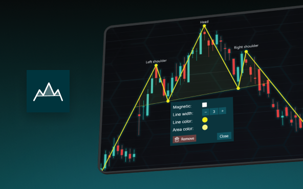
The Head and Shoulders Pattern in Technical Analysis
The Head and Shoulders Pattern in Technical Analysis The Head and Shoulders Pattern in Technical Analysis The Head and Shoulders pattern is one of the most recognized and widely used chart patterns in technical analysis. It is considered a reliable reversal pattern...

Best Telerik Charts Alternative in 2026: GPU Performance for WPF, WinForms, and Web
Telerik from Progress is a comprehensive UI component suite covering WPF, WinForms, ASP.NET, Blazor, and JavaScript. The charting components: RadChartView for WPF and WinForms, and Kendo UI Charts for web and Blazor, arrive bundled with the suite purchase. For teams...

Streaming Data Visualization with WebSockets (2026): The Complete Tutorial
Every WebSocket tutorial on the internet shows the same thing: a server sends a random number every second, a chart updates. It works. The demo looks great. Then you deploy to production, your IoT sensors push 800 updates per second across twelve channels, and the...


If you have any questions, feel free to contact us!
©LightningChart Ltd 2026. All rights reserved.