


Creating a Python Flight Tracking Application with Real-Time State Vector Data
Tutorial
Written by a Human
In this article, you'll learn how to create a Python flight tracking application using real-time state vector data and LightningChart Python.
Roy Liu
Data Science Python Developer
Python Flight Tracking Application with State Vector Data
Tracking flights in real time is made straightforward by leveraging structured JSON data provided by modern APIs. This project demonstrates how to build a flight tracking application using The OpenSky Network API for fetching state vector data and LightningChart Python for crafting dynamic, real-time visualizations.
What type of data is tracked?
The application tracks essential flight data, including latitude, longitude, altitude, velocity, and ICAO24 identifiers.
What are state vectors?
State vectors are a set of attributes that describe an aircraft’s position and motion at a given time. Key attributes include geographical coordinates, altitude and velocity.
About the data source
The data is sourced from The OpenSky Network API , an open platform providing real-time air traffic information. The API allows access to flight state vectors, which can be filtered by ICAO24, bounding boxes, or country origin.
Importance of Visualizing Air Traffic in Real-Time
Real-time air traffic visualization is crucial for aviation monitoring, providing insights into:
- Enhanced situational awareness: Monitoring aircraft positions, velocity, and altitude in real time.
- Air traffic management: Ensuring safer and more efficient airspace usage.
- Operational insights: Identifying patterns, delays, or anomalies in air traffic.
LightningChart Python
LightningChart Python is a high-performance charting library designed for real-time data visualization. It offers:
- Advanced visualization capabilities for dynamic data.
- Optimized performance for handling real-time data efficiently.
- Customization options for various chart types.

Setting Up Python Environment
To set up the Python environment for this Python flight tracking application project, you need to install Python and the necessary libraries such as LightningChart Python and OpenSky Network API. If needed, you can check the original project on GitHub.
Here’s a quick setup guide:
- Install Python: Download and install the latest version of Python from the official website.
- Install Libraries: Use
pipto install the required libraries:
pip install lightningchart PyQt5 pygame numpy- Set up your development environment by creating a new project directory and installing the required libraries. Ensure that LightningChart Python is properly licensed.
Installing the OpenSky Network API Library
The OpenSky Network API requires its Python library to fetch state vector data. Install it as follows:
- Clone or download the repository from OpenSky Network API Repository:
git clone https://github.com/openskynetwork/opensky-api.git- Navigate to the
pythondirectory and install the library. Alternatively, you can use pip without the-eoption if issues occur:
pip install -e /path/to/repository/python

//
pip install .
Overview of Libraries Used
- LightningChart Python: For creating high-performance, interactive data visualizations. (documentation)
- OpenSky Network API : For fetching state vector data. (documentation)
Loading and Processing Data
About the Python flight tracking application dataset, the state vector data includes attributes like ICAO24, callsign, position (latitude, longitude, altitude) and velocity. To fetch the data, the data is fetched directly from the OpenSky Network API using credentials. Below is an example snippet for fetching state vectors and targeting a specific flight based on its ICAO24 code:
from opensky_api import OpenSkyApi

# Initialize OpenSky API with credentials
api = OpenSkyApi("username", "password")

# Target flight's ICAO24
target_icao24 = "4601f5" # Replace with the desired ICAO24

# Fetch current states
states = api.get_states()

# Find the target flight
for s in states.states:
    if s.icao24 == target_icao24:
        print(f"Tracking {s.callsign}: Lat {s.latitude}, Lon {s.longitude}, Alt {s.geo_altitude}, Vel {s.velocity}, On Ground: {s.on_ground}")
Visualizing Data with LightningChart Python
The dashboard for this Python flight tracking application includes a polar chart for visualizing the flight’s path relative to a reference point, such as Helsinki Airport. To calculate the data for the polar chart, two helper functions are used: the Haversine formula for distance and a bearing calculation for direction.
Distance and Bearing Calculations
- Haversine Formula : Calculates the great-circle distance between two geographic points on the Earth’s surface, accounting for its curvature.
- Bearing Calculation : Computes the compass direction from the reference point to the target location.
These calculations are essential for plotting the flight’s position accurately on the polar chart. Below are the Python implementations of these functions:
def haversine(lat1, lon1, lat2, lon2):
    R = 6371  # Earth radius in kilometers
    dlat = radians(lat2 - lat1)
    dlon = radians(lon2 - lon1)
    a = sin(dlat / 2) ** 2 + cos(radians(lat1)) * cos(radians(lat2)) * sin(dlon / 2) ** 2
    c = 2 * atan2(sqrt(a), sqrt(1 - a))
    return R * c

def calculate_bearing(lat1, lon1, lat2, lon2):
    dlon = radians(lon2 - lon1)
    y = sin(dlon) * cos(radians(lat2))
    x = cos(radians(lat1)) * sin(radians(lat2)) - sin(radians(lat1)) * cos(radians(lat2)) * cos(dlon)
    return (degrees(atan2(y, x)) + 360) % 360
By using these functions, the polar chart dynamically updates to show the flight’s distance and direction relative to the chosen reference point.
Creating Charts
This Python flight tracking application project will feature four different charts:
- Polar Chart: For flight path tracking relative to a reference point.
polar_chart = dashboard.PolarChart()
polar_line_series = polar_chart.add_line_series()
polar_line_series.set_data(flight_path_data)- Line Chart: To visualize altitude over time.
altitude_chart = dashboard.ChartXY()
altitude_line_series = altitude_chart.add_line_series()
altitude_line_series.add(update_time_ms, altitude)- Altitude Gauge: To display the current altitude.
altitude_gauge = dashboard.GaugeChart()
altitude_gauge.set_title("Current Altitude (m)")
altitude_gauge.set_value(altitude)- Velocity Gauge : To display the current velocity.
velocity_gauge = dashboard.GaugeChart()
velocity_gauge.set_title("Current Velocity (m/s)")
velocity_gauge.set_value(velocity)
Customizing Visualizations
Visual elements such as titles, axis labels, and themes can be customized:
dashboard = lc.Dashboard(columns=5, rows=2, theme=lc.Themes.TurquoiseHexagon)
polar_chart.set_title("Flight Path Tracking")
altitude_chart.get_default_y_axis().set_title("Altitude (m)")
altitude_gauge.set_bar_thickness(6.0)
velocity_gauge.set_needle_thickness(4.0)
Streaming and Updating Data in Real Time
Data is updated periodically by fetching the latest state vectors and refreshing the visualizations.
while True:
    states = api.get_states()
    # Update data and charts here
    time.sleep(5)  # Fetch data every 5 seconds
Displaying Real-Time Data
The dashboard allows visualization with live updates:
dashboad.open(live=True)*API Credit Limitations
When using the OpenSky Network API, keep in mind that it has limitations on API credit usage for both anonymous and registered users. For detailed information about these limitations, refer to the OpenSky API documentation. In this Python flight tracking application project, we used a registered account to request data without specifying an area, which defaults to global scope and consumes more credits.
API credits are consumed based on the size of the requested area, with larger queries using more credits. For instance, querying a small area (less than 500×500 km) uses fewer credits than querying global data.
End Result
The final output of this Python flight tracking application project is a dynamic dashboard that visualizes real-time flight data, including:
- A polar chart showing the flight’s path relative to a reference point. We set Helsinki Airport as the reference point here.
- A line chart displaying altitude over time.
- Gauges for real-time altitude and velocity updates.
Conclusion
This Python flight tracking application project demonstrates the power of Python for real-time flight tracking by integrating the OpenSky Network API and LightningChart Python. By accessing and processing state vector data, the application visualizes key flight attributes dynamically and effectively.
LightningChart Python’s real-time rendering and high performance make it an excellent choice for creating robust, customizable visualizations, showcasing its capability to build advanced data visualization tools.
Continue learning with LightningChart
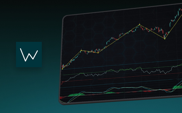
Elliott Wave Theory in Trading
Financial markets often appear chaotic, but many traders believe that price movements follow recurring patterns driven by human psychology. One of the most influential approaches based on this idea is the Elliott Wave Theory. Developed nearly a century ago, it remains one of the most widely studied methods of technical analysis.
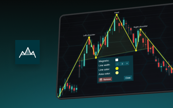
The Head and Shoulders Pattern in Technical Analysis
The Head and Shoulders Pattern in Technical Analysis The Head and Shoulders Pattern in Technical Analysis The Head and Shoulders pattern is one of the most recognized and widely used chart patterns in technical analysis. It is considered a reliable reversal pattern...
Best Telerik Charts Alternative in 2026: GPU Performance for WPF, WinForms, and Web
Telerik from Progress is a comprehensive UI component suite covering WPF, WinForms, ASP.NET, Blazor, and JavaScript. The charting components: RadChartView for WPF and WinForms, and Kendo UI Charts for web and Blazor, arrive bundled with the suite purchase. For teams...


If you have any questions, feel free to contact us!
©LightningChart Ltd 2025. All rights reserved.